

 ARL measures a number of different variables (wind speed, temperature, etc.,) to characterize the atmospheric boundary layer. This data on the surface and near surface weather and climate conditions is used to improve the accuracy of atmospheric models and other forecast and prediction tools. New measurement tools to characterize the boundary layer are in evaluation. For climate data, ARL provides high quality, reference-grade measurements through the US Climate Reference Network.
Boundary Layer Characterization

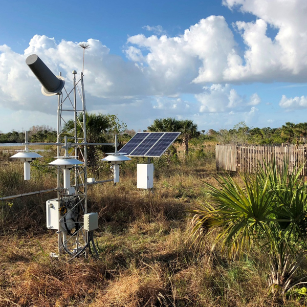
The US Climate Reference Network
Changes in the climate can influence economic prosperity, national security, and human and environmental health. Businesses, citizens, communities, governments, and international organizations are requiring accurate and high quality meteorological observations and forecasts to assess and adapt to current and potential threats associated with climate variability.
ARL operates and maintains the U.S. Climate Reference Network (USCRN), which provides long-term robust climate observations that are necessary to document climate change trends for the United States. The USCRN provides high quality, reference-grade measurements of critical climate measures such as air temperature, precipitation, winds, land surface temperature, and solar radiation and translates that information for decision-makers to understand how climate has changed and what changes might occur in the future. ARL’s activities focus on:
- advancing the quality and quantity of reference observations;
- evaluating select observing systems for their ability to satisfy ongoing and evolving climate requirements;
- improving the understanding of air-surface interactions; and
- analyzing long-term observational datasets and models to understand climate variability and change.
Mesonets: Meteorological Instrumentation & Mesonet Operations
ARL maintains a number of mesonets, or weather networks. The FRD division has continuously observed and recorded meteorological conditions at the Idaho National Laboratory (INL) and its environs since it first opened in 1948. The Idaho mesonet consists of 34-stations remotely managed in the INL Meteorological Monitoring Network (Mesonet). The network includes advanced hardware and software, meteorological towers, radio telemetry, a 915-MHz radar wind profiler and radio acoustic sounding system (RASS), and an H2O & CO2 eddy correlation flux system. There are currently 34 fully automated meteorological observation stations in operation at the INL and surrounding area. Thirteen of the stations are located within the boundaries of the INL. The remaining stations are sited at key locations throughout the Eastern Snake River Plain. Standard meteorological parameters are measured at each Mesonet station.
Small Uncrewed Aircraft Systems (sUAS)
Advances in the use of sUASs for atmospheric research promise new opportunities to make meteorological measurements in the lowest layer of the Earth’s atmosphere. ARL’s ATDD division uses this technology to measure changes of temperature, humidity, pressure, and wind with altitude, map the temperature and character of the Earth’s surface, and perform storm damage assessment in a way never before available that is faster, cheaper, and safer than traditional aircraft. sUAS systems can also reach intermediate layers of the atmosphere – roughly 3000 feet above ground level – that had previously been difficult to sample on a routine basis, as illustrated in the figure below.
The project was designed to build a long-term testbed near Oak Ridge, Tennessee to:
- Evaluate new sUAS technologies
- Support operations at the local National Weather Service Weather Forecast Office in Morristown, Tennessee
- Use sUAS and flux tower observations to develop and refine new surface-layer parameterizations for heat, moisture, and momentum exchange used in numerical weather prediction models
- Use sUAS for storm damage assessments
- Evaluate technologies to enable sUAS to obtain automatic meteorological measurements


