

DCNet – Predecessor to UrbanNet
Dating back to the tragic events of September 11, 2001, there was a realization on the part of the homeland security community that chemical, biological agent, or radioactivity releases in a prime terrorist target location as Washington, DC were a distinct possibility. DCNet grew out of a recognition by dispersion scientists within the Air Resources Laboratory (ARL) of NOAA that society now faces a critical question. How do we forecast dispersion in urban areas and in cities when the meteorological data used by the weather forecasting community are from locations outside the area of probable concern?
As such, DCNet was a meteorology research program established by NOAA for the DC/National Capital Region as a response to potential threats following the September 11, 2001 attacks on the U.S. Initial goals of DCNet were to explore variations in model inputs for both numerical weather prediction (NWP) as well as atmospheric transport and dispersion models (AT&D), to assimilate urban observations into both numerical weather prediction and atmospheric transport models, and the provision of real-time meteorological observations over the greater NCR to support current numerical weather prediction models as well as provide the driving meteorological observations for atmospheric transport and dispersion models.
The station locations for DCNet were located at:
- U.S. Department of Commerce – Herbert C. Hoover Building, Washington DC – a dual system;
- Washington DC’s Emergency Management Agency in SE Washington DC;
- The headquarters of the National Education Association in Washington DC;
- The Washington DC Government’s Frank Reeves Municipal Center;
- Howard University in Washington DC; and
- C-SPAN towers in upper northwest Washington, DC
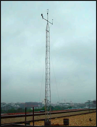
DCNet tower with a sonic anemometer at the top of a roof-mounted 10 meter tower. A standard set of meteorological instrumentation is mounted slightly below. This installation was on the roof of the U.S. Department of Commerce building, in the Federal Triangle area of downtown Washington, D.C.
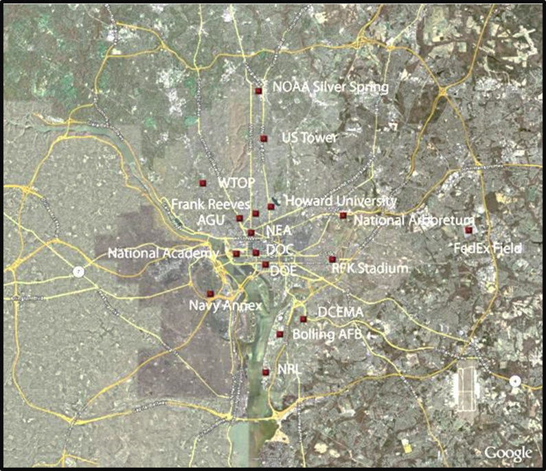
Location of the DCNet sites in and around the District of Columbia, as of November 2008 (Pendergrass et al, 2008)