ARL Weekly News – September 2, 2022
| Recent Events |
2021 Edition of the State of the Climate Report Now Available
The 2021 edition of the annual State of the Climate Report was published and released on August 31st. The report, compiled by NOAA’s National Centers for Environmental Information, is based on contributions from scientists from around the world. It provides a detailed update on global climate indicators, notable weather events, and other data collected by environmental monitoring stations and instruments located on land, water, ice, and in space. This is the 32nd issuance of the annual assessment now known as State of the Climate, published in the Bulletin since 1996. This year’s report is based on contributions from more than 530 scientists from over 60 countries around the world and reflects tens of thousands of measurements from multiple independent dataset. It provides the most comprehensive update on Earth’s climate indicators, notable weather events and other data collected by environmental monitoring stations and instruments located on land, water, ice and in space.
As a supplement to the Bulletin, its foremost function is to document the status and trajectory of many components of the climate system. ARL’s Dr. Howard Diamond served as the Lead Editor for the Tropics Chapter, and this issue marked his 17th year in that role, and his plan is to do this for his 18th edition for the 2022 report. The Tropics Chapter can be found at https://ametsoc.net/sotc2021/Chapter%204-BAMS-SoC2021-final.pdf, and the full report can be found at https://www.ametsoc.org/index.cfm/ams/publications/bulletin-of-the-american-meteorological-society-bams/state-of-the-climate/ An article on the NOAA Climate Portal summarizing the entire report can be found at https://www.climate.gov/news-features/understanding-climate/international-report-2021-climate-record-high-greenhouse-gases
Among its findings, the Tropics Chapter portion of the report documented that there were 97 named tropical storms during the Northern and Southern Hemisphere storm seasons last year, well above the 1991–2020 average of 87. Seven tropical cyclones reached Category 5 intensity on the Saffir–Simpson Hurricane Wind Scale. The North Atlantic hurricane basin recorded 21 named storms, the third most for the basin, behind the record 30 cyclones in 2020 and 28 in 2005. Category 4 Hurricane Ida was the most impactful storm in the Atlantic. At $75 billion (U.S. dollars) in damage, Ida was the costliest U.S. disaster of 2021 and the fifth most expensive hurricane on record since 1980. Super Typhoon Rai was the third-costliest typhoon in the history of the Philippines causing about $1 billion (U.S. dollars) in damages and more than 400 deaths.
Research Flights Over Washington Region Measure Atmospheric Chemistry.
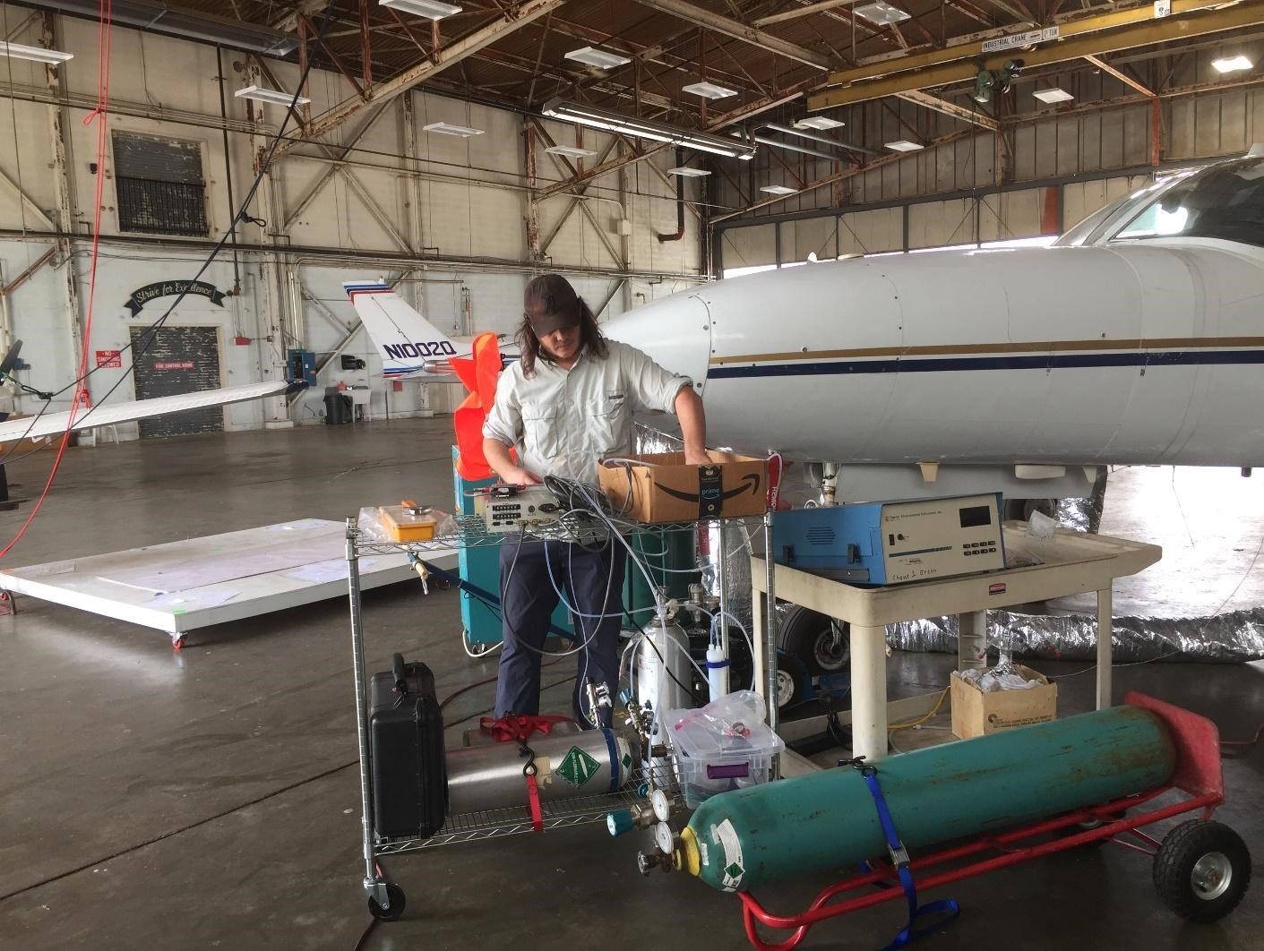
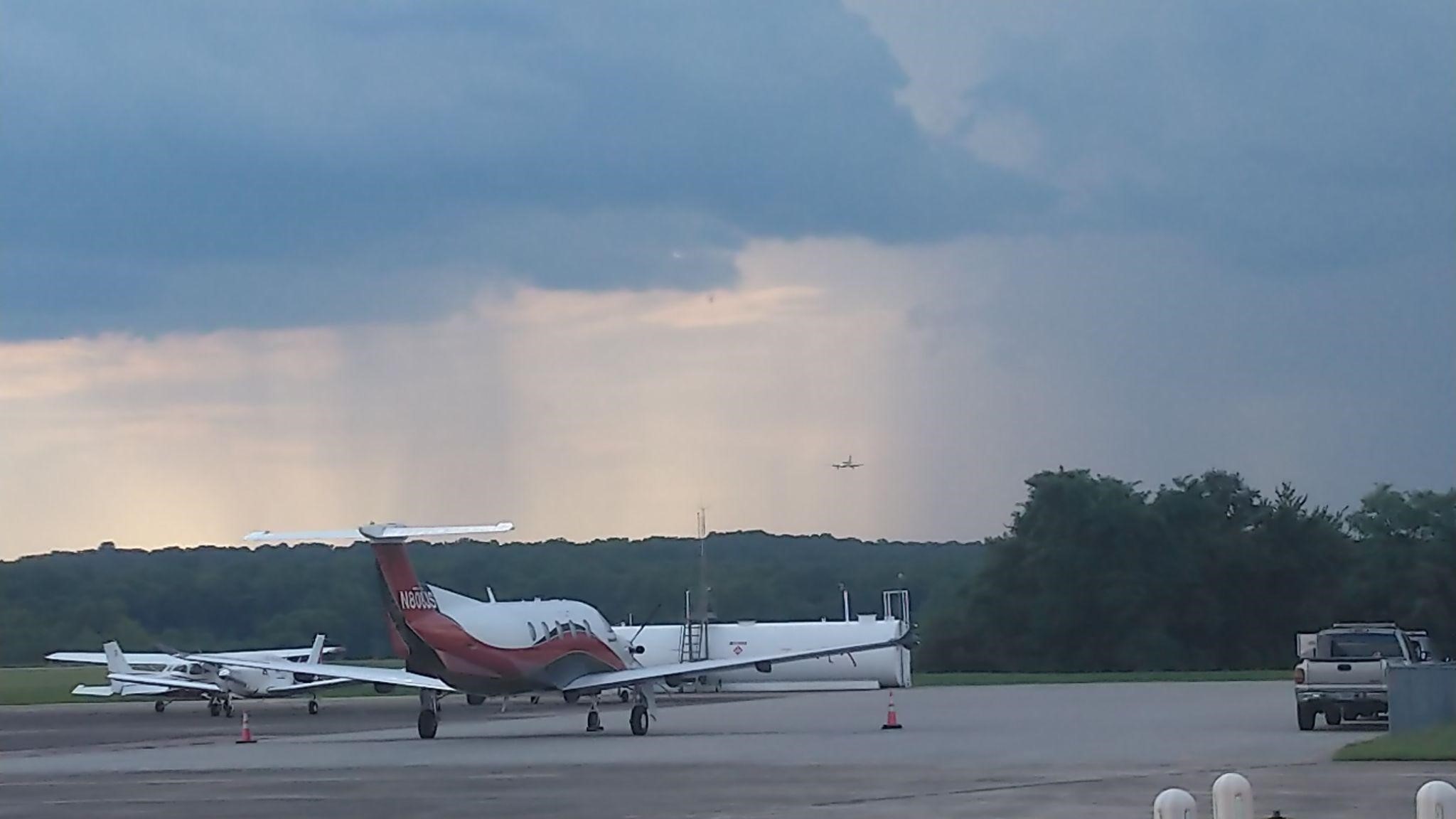
Over the summer of 2022, Phil Stratton and Xinrong Ren have been involved in research flights focusing on air quality and greenhouse gas emissions over the Washington, DC and Baltimore area. In collaboration with University of Maryland, Johns Hopkins University, Maryland Department of Environment, and University Research Foundation, research flights have been conducted in this area on sunny and hot days to characterize high ozone events. A Cessna 402 research aircraft was used in this study and measurements include meteorology and chemical parameters such as ozone, nitrogen oxides, volatile organic compounds, carbon monoxide, and greenhouse gases such as carbon dioxide and methane. Data collected from these flights will be further analyzed to investigate summer ozone photochemistry and to provide policy-relevant scientific information for regulatory agencies such as Maryland Department of Environment.


| Papers Published |
Brune, W. H., Jenkins, J. M., Olson, G. A., McFarland, P. J., Miller, D. O., Mao, J., & Ren, X. (2022). Extreme hydroxyl amounts generated by thunderstorm-induced corona on grounded metal objects. Proceedings of the National Academy of Sciences of the United States of America, 119(37), e2201213119. https://doi.org/10.1073/pnas.2201213119
Abstract: Atmospheric electrical discharges are now known to generate unexpectedly large amounts of the atmosphere’s primary oxidant, hydroxyl (OH), in thunderstorm anvils, where electrical discharges are caused by atmospheric charge separation. The question is “Do other electrical discharges also generate large amounts of oxidants?” In this paper, we demonstrate that corona formed on grounded metal objects under thunderstorms produce extreme amounts of OH, hydroperoxyl (HO2), and ozone (O3). Hundreds of parts per trillion to parts per billion of OH and HO2 were measured during seven thunderstorms that passed over the rooftop site during an air quality study in Houston, TX in summer 2006. A combination of analysis of these field results and laboratory experiments shows that these extreme oxidant amounts were generated by corona on the inlet of the OH-measuring instrument and that corona are easier to generate on lightning rods than on the inlet. In the laboratory, increasing the electric field increased OH, HO2, and O3, with 14 times more O3 generated than OH and HO2, which were equal. Calculations show that corona on lightning rods can annually generate OH that is 10-100 times ambient amounts within centimeters of the lightning rod and on high-voltage electrical power lines can generate OH that is 500 times ambient a meter away from the corona. Contrary to current thinking, previously unrecognized corona-generated OH, not corona-generated UV radiation, mostly likely initiates premature degradation of high-voltage polymer insulators.
McKinney, Todd, Nick Perlaky, Evan Danielson, Areeb Mohammed, Jackson Lee, Ben O’Bryan, Connor Stoll, Clara Hochmuth, Tyler Gallien, Skyler Kerr, Timothy Johnson, Chris Shiffer, Sean Hassler, Ethan Jankens, Mariama Feaster, Connor Morris, Zeb Leffler, Alice Crawford, Mark Cohen, Michael Newchurch, Bill Brown, Paula Tucker, and Kevin Knupp. “Around the World They Go: Circumnavigating Balloon Satellites!”, Bulletin of the American Meteorological Society (published online ahead of print 2022), accessed Sep 7, 2022, https://doi.org/10.1175/BAMS-D-21-0135.1
Abstract: Students from the University of Alabama in Huntsville successfully deployed three micro super-pressure balloon satellites in winter 2021. Students planned and implemented all phases of the project from obtaining funding, determining project timelines, preparing equipment, launching balloons, designing and implementing a website, writing daily blogs on the balloon progress, and analyzing the data. The objective of the flights was to use the balloons as a meteorological tools to study conditions in the lower stratosphere (12 – 14 km), as a tracer for evaluating modeled air parcel trajectories, and as an outreach and educational tool. The three balloons successfully traveled hundreds of thousands of kilometers, making an accumulated total of 16 global circumnavigations. Toughout the project, students made connections with hundreds of researchers, ham radio operators, STEM groups, and other students around the globe. The balloons provided velocity telemetry within many different weather regimes, including vigorous jets over the Himalayas, slow-moving equatorial air masses over the middle of the Pacific Ocean, and dense polar air masses over the Arctic Circle. This study has found that the accuracy of HYSPLIT calculated trajectories using Numerical Weather Predication (NWP) meteorological data can be quantified using parcel velocity, duration of trajectory forecast, and spatial resolution of the NWP model.
Baker, C.B., Cosh, M., Bolten, J., Brusberg, M., Caldwell, T., Connolly, S., Dobreva, I., Edwards, N., Goble, Tyson P.E., Ochsner, E., Quiring, S.M., Robotham, M., Skumanich, M., Svoboda, M., White, W.A., and Woloszyn, M. “Working toward a National Coordinated Soil Moisture Monitoring Network: vision, progress, and future directions”, Bulletin of the American Meteorological Society (published online ahead of print 2022), accessed Sep 7, 2022, https://doi.org/10.1175/BAMS-D-21-0178.1
Abstract: Soil moisture is a critical land surface variable, impacting the water, energy, and carbon cycles. While in situ soil moisture monitoring networks are still developing, there is no cohesive strategy or framework to coordinate, integrate, or disseminate these diverse data sources in a synergistic way that can improve our ability to understand climate variability at the national, state, and local levels. Thus, a national strategy is needed to guide network deployment, sustainable network operation, data integration and dissemination, and user-focused product development.
The National Coordinated Soil Moisture Monitoring Network (NCSMMN) is a federally-led, multi-institution effort that aims to address these needs by capitalizing on existing wide-ranging soil moisture monitoring activities, increasing the utility of observational data, and supporting their strategic application to the full range of decision making needs.
The goals of the NCSMMN are to:
- Establish a national “network of networks” that effectively demonstrates data integration and operational coordination of diverse in situ networks;
- Build a community of practice around soil moisture measurement, interpretation, and application – a “network of people” that links data providers, researchers, and the public;
- Support research and development (R&D) on techniques to merge in situ soil moisture data with remotely-sensed and modeled hydrologic data to create user-friendly soil moisture maps and associated tools.
The overarching mission of the NCSMMN is to provide coordinated high-quality, nationwide soil moisture information for the public good by supporting applications like drought and flood monitoring, water resource management, agricultural and forestry planning, and fire danger ratings.
| Papers Accepted |
Adjustment of solid precipitation during the Filomena extreme snowfall event in Spain: from observations to “true precipitation” was accepted for publication in The Bulletin of the American Meteorology Society. The manuscript describes a significant snow event that occurred in January 2021 over central Spain. It deposited 50 cm of precipitation in Madrid, and caused the closure of Barajas Airport and the cancellation of all trains in and out of Madrid. Precipitation measurements were inconsistent with other snow observations. This was due to undercatch caused by wind, and was addressed in the article using transfer functions, It was written by Samuel Buisan, Roberto Serrano-Notivoli, John Kochendorfer, and Francisco J. Bello-Millán.

