ARL Collaborates with the University of Tennessee Space Institute
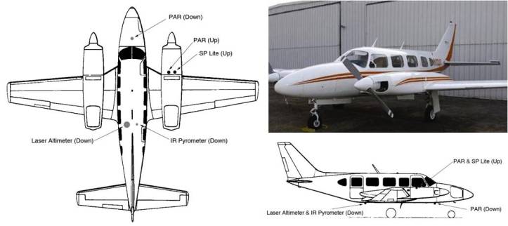
The Air Resources Laboratory’s Atmospheric Turbulence and Diffusion Division (ATDD) is collaborating with the University of Tennessee Space Institute’s (UTSI) Aviation Systems and Flight Research Department to collect measurements of the Earth’s skin (or surface) temperature, utilizing an instrumented aircraft flying over selected U.S. Climate Reference Network (CRN) sites. The UTSI is providing their Piper Navajo aircraft, and ATDD is providing most of the on-board instruments. The first test flight is scheduled for early February, 2010 over two locations in Tennessee. Additional flights are scheduled, one for each remaining season through FY10.

Background: The U.S. Climate Reference Network records five climate parameters, including a single data point of skin temperature. Satellite measurements, such as those made from the NOAA Geostationary Operational Environmental Satellite-R Series, provide skin temperature data over a larger spatial area. This study was designed by ATDD scientists to provide more accurate ground-truth data to better understand the representativeness of the CRN data-point to the surrounding area that falls within the satellite footprint. ATDD will evaluate all of the data collected.
Significance: The lack of high quality surface measurements historically has hampered the ability of climate scientists to fully characterize the national and regional climate signals with confidence. Accurate data of the Earth’s skin temperature are necessary to improve climate models and improve the accuracy of weather forecasting. The measurements collected from sites in regions of differing climates and vegetation cover will validate the satellite-derived data, which is critical to the satellite algorithms for retrieving variables from the remotely sensed data and to assess its quality and reliability.

