Flux Measurement Study Underway in Delaware
July 2018
July 2018
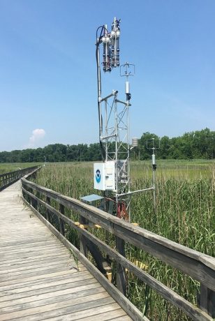
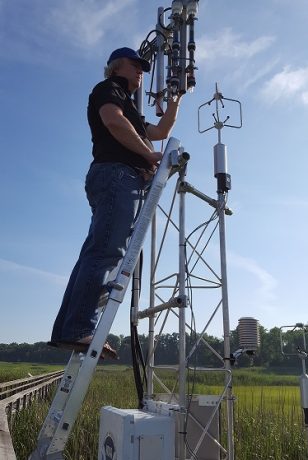
On June 18, a team of scientists from ARL’s Atmospheric Turbulence and Diffusion Division (ATDD), the NOAA Beaufort Laboratory, University of Delaware (UD), and Delaware National Estuarine Research Reserve (DNERR) kicked off a month long field study in Dover, Delaware. ATDD’s LaToya Myles, Rick Saylor, Nebila Lichiheb, Mark Heuer, Simone Klemenz, and Dave Senn are participating in the study taking place at the DNERR St. Jones Reserve, a 700-acre sanctuary.
The team will collect air, water, vegetation, and sediment samples to determine cycling of ammonia, carbon dioxide, methane, and other gases in the coastal marsh environment. They’ll then use several different techniques specific to micrometeorology (e.g. on a small scale in terms of space and time) to determine the exchange, or vertical movement, of gases from air to land and back again. The term for this exchange rate is flux and it helps scientists to understand the fate and impact of gases delivered by atmospheric processes to surface water and sediment/soil.
Coastal ecosystems are one of the most complex areas within ecosystem science because their borders include land, water, and multiple different types of vegetation. (Ecosystems are comprised of living organisms, the environment, and their interactions). The amount of available atmospheric flux data is limited in the U.S. and measurements are difficult because many different variables must be factored into the analysis; the very reasons why it’s so important for scientists to take measurements and to understand the possible magnitude of their impacts on carbon storage, water quality, and other processes.
The team spent nearly a year vetting possibly locations to conduct their study before deciding on a pier accessible from the DNERR site. Key reasons for selection included opportunities to leverage existing water quality data from NOAA’s System-Wide Monitoring Program and from the University of Delaware’s AmeriFlux tower (part of a community of sites and scientists taking and sharing relevant measurements to further scientific understanding).
ATDD’s collaboration with Carolyn Currin and others at the NOAA Ocean Service laboratory in Beaufort, North Carolina, provides a cross-line office opportunity to bridge coastal dynamics expertise with atmospheric flux knowledge, resulting in a unique, interdisciplinary study. The Beaufort group is providing data on marsh surface elevation and vegetation canopy biomass and height to generate a Digital Elevation Model, and is supporting efforts to understand how inundation impacts flux measurements. Furthering collective efforts, scientists and students from both the NERR site and UD will take complementary measurements with their own equipment.
This study supports NOAA’s efforts to provide accurate environmental information about natural atmospheric and ecosystem exchange processes.

