Terrain Height |
|||
 Previous |
 Next |
|
|
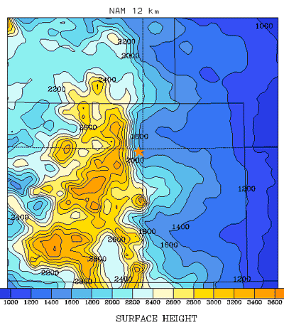
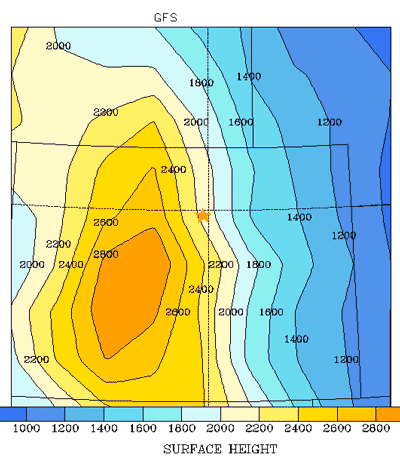
| As an example of how one might define a starting trajectory height, examine the location for Broomfield (KBJC), Colorado, at 39.92N and 105.12W, which has a surface height of 1724 m ASL. (If we did not know the terrain height for Broomfield, we could estimate it using the profile program for several different data sets (right) by taking the difference between the surface pressure (PRSS) and mean sea-level pressure (MSLP) and multiplying the result by 10 m per hPa, which is the approximate relation of height to pressure and is a function of the air density.) |
|
The terrain heights for the NAM 12 km (left) and GFS (right) are shown below (Bloomfield is indicated by the orange star). The terrain in the vicinity of Bloomfield is much smoother in the coarser GFS than the NAM and the terrain gradient is much steeper in the NAM and therefore we would expect to see differences in the terrains. Also, when the model terrain is consistently above the true terrain, one might suspect that the station location is in a valley, as in this case. In this situation, all one can do is assume that true ground-level is at the model's terrain height and proceed with the realization that the lower levels of the flow field may at times be constrained in ways that are not evident in the coarser gridded meteorological data fields.
 |
 |
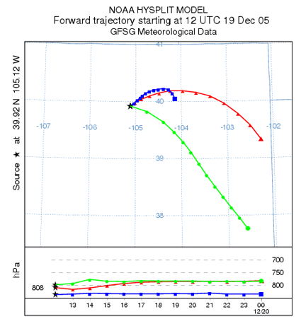
In the example below we compare the NAM 12 km trajectory (blue) to the MM5 45 km (green), and the 1 degree GFS (red) originating from 10 m AGL. Even though all the trajectories start out at the same height AGL, they start at different pressure levels due to differences in elevation between the data.
Previous |
Next |