Meteorological Data Requirements |
|||
 Previous |
 Next |
|
|
File characteristics and projection
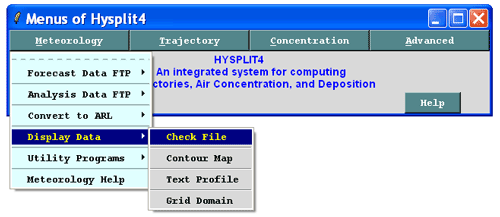
HYSPLIT requires that meteorological data fields be projected on a conformal map projection (Polar Stereographic, Lambert, or Mercator) or a regular latitude-longitude grid. The data must be organized with one record per variable per level and all records must have the same record length. Records are written in a forward time sequence. More details on the format and packing of the meteorological data can be found in the HYSPLIT User's Guide.The \exec directory contains several command line programs (chk_data, chk_rec) that can be used to analyze a HYSPLIT compatible meteorological data file. chk_file has been incorporated into a HYSPLIT GUI under the Meteorology / Display Data menu.
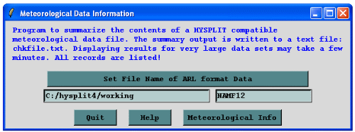
Running Check File prompts the user for the location of a HYSPLIT compatible dataset. (It is best to store all HYSPLIT compatible data sets in a directory whose name does not contain spaces as these can confuse the TCL scripts).
Meteorological Variables
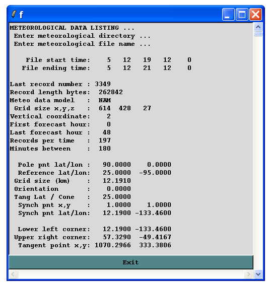
A unique 4-character string identifies meteorological variables. The minimum requirements to run the model are the U and V wind components (UWND, VWND), ambient temperature (TEMP), height (HGTS) of the data level (if on pressure coordinates), and the surface pressure (PRSS). A sample extract of section 2 of the chk_file program is shown below for the NAM 12 km dataset for levels between the surface and 925 hPa.
Index     Level  #   Variable listing and checksum values
.....
   5   925.0000  7   UWND 108  VWND 236  HGTS 230  TEMP 123  WWND  82  RELH  20
                 TKEN  47
   4   950.0000  7   UWND 147  VWND 129  HGTS 103  TEMP  89  WWND 155  RELH 121
                 TKEN  86
   3   975.0000  7   UWND  47  VWND 209  HGTS 178  TEMP 193  WWND 125  RELH 252
                 TKEN  82
   2  1000.0000  7   UWND  49  VWND 234  HGTS 138  TEMP 124  WWND 234  RELH  62
                 TKEN 198
   1     0.0000 14   SHGT 101  MSLP 235  TPP3 184  CPP3 184  T02M 215  RH2M  41
                 U10M 119  V10M 212  PRSS  53  LHTF 120  SHTF 206  USTR 215
                 RGHS 177  DSWF 194
Data Records
Each data record is composed of a 50 byte ASCII header portion, describing the data packing, followed by the packed data of length (I*J bytes). A one-byte per element “difference packing” is used for all data fields. The first data record (INDX) of each time period contains information on the variables, levels, grid, and checksums. A sample extract of the final section from the chk_file program is shown below for the NAM 12 km data set.
     #  YYMMDDHHFHLLGG FLD EXP    PRECISION       VAR(1,1)

     1   5121912 0 099INDX   0 0.0000000E+00 0.0000000E+00
     2   5121912 0 099SHGT  11 0.8062992E+01 0.0000000E+00
     3   5121912 0 099MSLP   4 0.6299213E-01 0.1016970E+04
     4   5121912 0 099TPP3   1 0.7874016E-02 0.0000000E+00
     5   5121912 0 099CPP3   1 0.7874016E-02 0.0000000E+00
     6   5121912 0 099T02M   4 0.6299213E-01 0.2983304E+03
     7   5121912 0 099RH2M   6 0.2519685E+00 0.8621770E+02
     8   5121912 0 099U10M   4 0.6299213E-01-0.7976649E+01
     9   5121912 0 099V10M   4 0.6299213E-01 0.1462120E+01
    10   5121912 0 099PRSS   7 0.5039370E+00 0.1017162E+04
    11   5121912 0 099LHTF   9 0.2015748E+01-0.1431365E+03
    12   5121912 0 099SHTF   9 0.2015748E+01-0.1035156E+02
    13   5121912 0 099USTR -25 0.1173320E-09 0.1000000E+00
    14   5121912 0 099RGHS  -2 0.9842520E-03 0.1590000E-04
    15   5121912 0 099DSWF   7 0.5039370E+00 0.0000000E+00
    16   5121912 0 199UWND   4 0.6299213E-01-0.9166061E+01
    17   5121912 0 199VWND   4 0.6299213E-01 0.1795837E+01
    18   5121912 0 199HGTS   5 0.1259843E+00 0.1470268E+03
    19   5121912 0 199TEMP   4 0.6299213E-01 0.2967743E+03
    20   5121912 0 199WWND  -6 0.6151575E-04 0.8997059E-03
    21   5121912 0 199RELH   6 0.2519685E+00 0.8856895E+02
    22   5121912 0 199TKEN   4 0.6299213E-01 0.5000000E+00
    23   5121912 0 299UWND   4 0.6299213E-01-0.9460953E+01
    24   5121912 0 299VWND   4 0.6299213E-01 0.1790451E+01
    25   5121912 0 299HGTS   5 0.1259843E+00 0.3694624E+03
    26   5121912 0 299TEMP   4 0.6299213E-01 0.2946380E+03
    27   5121912 0 299WWND  -5 0.1230315E-03 0.1221895E-02
    28   5121912 0 299RELH   6 0.2519685E+00 0.9656725E+02
    29   5121912 0 299TKEN   5 0.1259843E+00 0.7500000E+00
    ........
Concatenating Meteorology Files
HYSPLIT compatible meteorology files can be concatenated by using the UNIX
cat or DOS type command.
For example, to concatenate file2 to the end of file1 in a DOS window type:
and for UNIX type:
Previous |
Next |