Source Attribution via Back Trajectories |
|||
 Previous |
 Next |
|
|
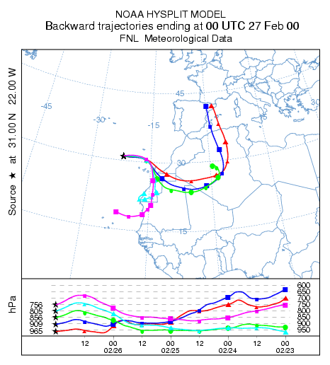
Frequently it is necessary to attribute a pollutant measurement to a specific source location. One approach is to compute a backward trajectory to determine the air’s origin. Although it is not uncommon to see sources identified by a single trajectory, the uncertainties inherent in a single-trajectory can preempt its utility. One way to reduce those uncertainties would be to compute multiple trajectories, in height, time, and space. For instance, if we use the previous example of dust off the coast of Africa at 0000 UTC on February 27th as a starting point, a 96 hour backward trajectory calculation for multiple heights clearly shows transport at all levels from west-central Africa.
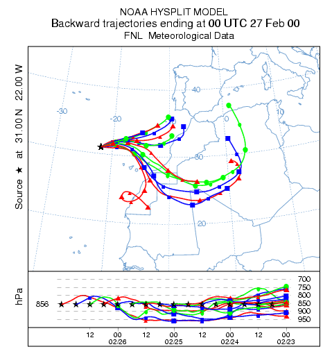
Quickly changing meteorological conditions can also contribute to uncertainty, especially if a pollutant sample represents an average rather than a snapshot concentration. Next, reset the starting height to only 1500 m and from the Advanced / Configuration Setup / Trajectory / Multiple trajectories in time menu set the restart interval to 6 hours. Over the 4-day period, there is an obvious split in the source of the air with a group over northwestern Africa and Southern Spain and another group over west-central Africa. Closer examination of the trajectory output file would determine when the temporal shift occurred. In this case it was around 1200 UTC on February 26.
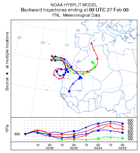
The third variation is to examine the spatial sensitivity. In this simulation, set four additional starting points, offset by 1 degree from the central location (delete and run without the SETUP.CFG). The result shows a division in the flow properties with some trajectories moving slower and lower and some moving faster and higher.
Previous |
Next |